Training on Geospatial Data Integration and Visualization: Techniques for Complex Data Analysis

Course Overview
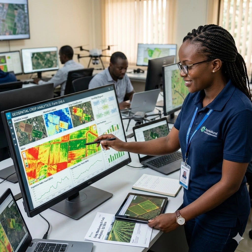
This course equips participants with advanced skills in integrating, processing, and visualizing geospatial data for complex analysis across diverse sectors. Participants will learn how to combine data from multiple sources including satellite imagery, GIS layers, LiDAR, IoT sensors, and field-collected datasets to create comprehensive spatial analyses that inform strategic decision-making. The training emphasizes hands-on exercises, workflows, and real-world case studies to ensure practical application of concepts.
Participants will explore techniques for data cleaning, alignment, fusion, and transformation to generate meaningful visualizations and dashboards. By using tools such as ArcGIS, QGIS, Python, R, Google Earth Engine, and data visualization platforms, learners will gain the ability to transform raw geospatial data into insightful maps, reports, and interactive displays. The course also covers spatial analytics, pattern detection, and multi-layered visualization techniques to support evidence-based planning and operational decisions.
By the end of this 10-day program, participants will be able to manage complex geospatial datasets, implement data integration workflows, and create advanced visualizations for urban planning, environmental monitoring, disaster management, and other strategic applications. Attendees will also gain the capability to communicate spatial insights effectively to stakeholders, enhancing decision-making, resource allocation, and project outcomes.
Duration
10 Days
Who Should Attend
• GIS analysts, specialists, and technicians
• Data scientists and researchers working with spatial data
• Environmental planners and urban development professionals
• Disaster risk reduction and humanitarian response practitioners
• Government officials and policymakers using geospatial information
• Professionals in agriculture, health, climate, or infrastructure sectors
Course Impact
Organizational Impact
-
Strengthened capacity to integrate and visualize complex datasets for planning and decision-making
-
Improved project outcomes through advanced geospatial data analysis
-
Enhanced ability to communicate findings with interactive and visually compelling outputs
-
Greater alignment with data-driven policies and global best practices
Individual Impact
-
Proficiency in integrating geospatial data from multiple sources
-
Strong skills in visualization techniques for complex data analysis
-
Ability to apply geospatial insights in diverse real-world contexts
-
Expanded career opportunities in GIS, data science, and applied research fields
Course Objectives
By the end of this course, participants will be able to:
-
Understand principles of geospatial data integration and visualization
-
Combine datasets from multiple sources into unified geospatial frameworks
-
Apply advanced visualization tools and techniques for complex data analysis
-
Communicate geospatial insights effectively to technical and non-technical audiences
-
Draw lessons from case studies to strengthen decision-making across sectors
Course Outline
Module 1: Fundamentals of Geospatial Data Integration
-
Types and sources of geospatial data
-
Challenges in managing complex datasets
-
Case Study: Integrating satellite imagery and field data for urban planning
Module 2: Data Cleaning, Processing, and Standardization
-
Preprocessing raw geospatial data
-
Handling inconsistencies and missing values
-
Case Study: Data preparation for land-use and land-cover mapping
Module 3: Spatial Data Integration Techniques
-
Combining raster and vector datasets
-
Using databases and APIs for integration
-
Case Study: Integrating environmental and socioeconomic datasets
Module 4: Visualization Principles for Geospatial Data
-
Fundamentals of cartography and design
-
Choosing the right visualization techniques
-
Case Study: Visualizing climate vulnerability zones
Module 5: Advanced Visualization Tools and Methods
-
Interactive dashboards and web mapping
-
3D visualization and story maps
-
Case Study: Building a web map for disaster response planning
Module 6: Complex Data Analysis with Geospatial Tools
-
Spatial modeling and predictive analysis
-
Machine learning applications in geospatial contexts
-
Case Study: Predicting agricultural yield using integrated datasets
Module 7: Communicating Geospatial Insights
-
Tailoring visualization for different stakeholders
-
Effective reporting with maps, graphs, and dashboards
-
Case Study: Using geospatial insights for policy advocacy
Module 8: Data Security, Ethics, and Governance in Geospatial Work
-
Managing sensitive data
-
Ethical considerations in visualization and analysis
-
Case Study: Geospatial data use in humanitarian crises
Module 9: Applied Sectoral Case Studies
-
Agriculture, food security, and climate change
-
Urban development and infrastructure
-
Public health and epidemiology
-
Case Study: Visualizing pandemic spread through integrated data
Module 10: Future Trends and Capstone Case Study
-
Big data, AI, and geospatial analytics
-
Emerging visualization technologies (AR/VR, real-time dashboards)
-
Case Study: End-to-end geospatial data integration and visualization project
Prerequisites
Course Administration and Investment
Whether you join us in a physical boardroom or through our virtual campus, we’ve designed every administrative detail for a seamless, professional experience.
Our fees are all inclusive during course hours.
- Covered: High level tuition, comprehensive materials (digital + physical), mid morning and afternoon refreshments, a full executive lunch, and any scheduled study visits or site tours.
- Not covered: Travel, visa fees, medical/travel insurance, personal expenses, and accommodation.
From registration to the classroom, we keep things clear and efficient.
- Registration: Find your preferred schedule, click “Register,” complete the form, and submit. Need help? Talk to us directly.
- Pre Course Assessment: After registering, you’ll receive a diagnostic survey to help facilitators tailor content to your needs.
- Joining Instructions: Once fees are paid, you’ll receive a Delegate Welcome Pack at least 7 days before the start date (venue maps, virtual access links, and pre reading materials).
We provide premium environments optimized for adult learning and networking.
- Physical Venues: Premium 4 star and 5 star executive boardrooms across our global host cities, with high tier catering.
- Virtual Instructor Led Training (VILT): High definition, interactive platforms featuring breakout rooms, digital whiteboards, and live technical support.
- NITA and Regulatory Compliance: Administrative processes align with national training authorities.
You’ll leave with tools that extend the course value far beyond the final day.
- ForElite Learner Kit: A physical or digital course manual, proprietary templates, and a curated toolkit of industry standard SOPs.
- On Site / In App Support: Dedicated course coordinators handle technical, dietary, or logistical inquiries in real time.
We validate your commitment to excellence with internationally recognized credentials.
- Attendance Tracking: Rigorous daily logging to meet corporate and regulatory accreditation requirements.
- Verifiable Credentials: Upon successful completion, you receive a certificate of course completion.
Our relationship with you doesn’t end when the course closes.
- Feedback & ROI Reporting: Detailed post course evaluations to give sponsors clear insight into training impact.
- Alumni Network Access: Every delegate joins the ForElite Alumni Network for ongoing peer to peer learning and exclusive webinars.
When is the next intake?
UpdatedWe offer customized training solutions tailored to your organization's specific needs (location, dates, content and team size).
Talk to us and we’ll guide you on the best schedule and format for your team.
Training Methodology
We turn knowledge into results. Using our P.E.A.K. Framework (Prepare, Engage, Apply, Know), every participant leaves with practical skills they can use immediately.
Proven Impact
In the last 12 months, over 1,200 professionals have applied the P.E.A.K. Framework to reduce onboarding time by an average of 30% and accelerate project delivery across 14 industries.
The outcome: Participants don’t just learn. They gain the tools, confidence, and strategy to drive measurable impact.
Tailor-Made Training and Customization
Off-the-shelf solutions rarely fit perfectly. At ForElite Training Institute, we built our Tailor-Made Training (TMT) service to embed our expertise directly into your unique strategy, culture, and operations.
We replace generic examples with scenarios from your sector (e.g., public sector, NGOs, financial services, or logistics).
Choose a format that fits your operations: intensive 3 day bootcamps or weekly sessions that minimize work disruption.
We teach directly from your actual templates, brand guidelines, or financial reports.
Host your bespoke training in any of our 21+ global cities, or we'll send facilitators to your office anywhere in the world.
Course Reviews
Share your experience to help others choose the right course.
Leave a Review
Your review will be published after verification.
Most Recent Reviews
Showing the most recent reviews.
Training on Geospatial Data Integration and Visualization: Techniques for Complex Data Analysis FAQs
Quick answers to common questions about this course
You May Also Be Interested In
Explore more courses in this category
 Intermediate
 Advanced
 Intermediate
 Advanced
Intermediate
Advanced
Intermediate
Advanced
Advanced
Intermediate
Advanced
Intermediate
Advanced

SECURE YOUR COMPETITIVE ADVANTAGE TODAY.
Subscribe to the Premier Intel newsletter for weekly market insights and training updates.
About Us


ForElite Training Institute is a global institutional capacity-building and EdTech partner that empowers organizations and professionals with transformative, high-impact learning.