Training on GIS and Remote Sensing for Sustainable Forest Monitoring and Management
Course Overview
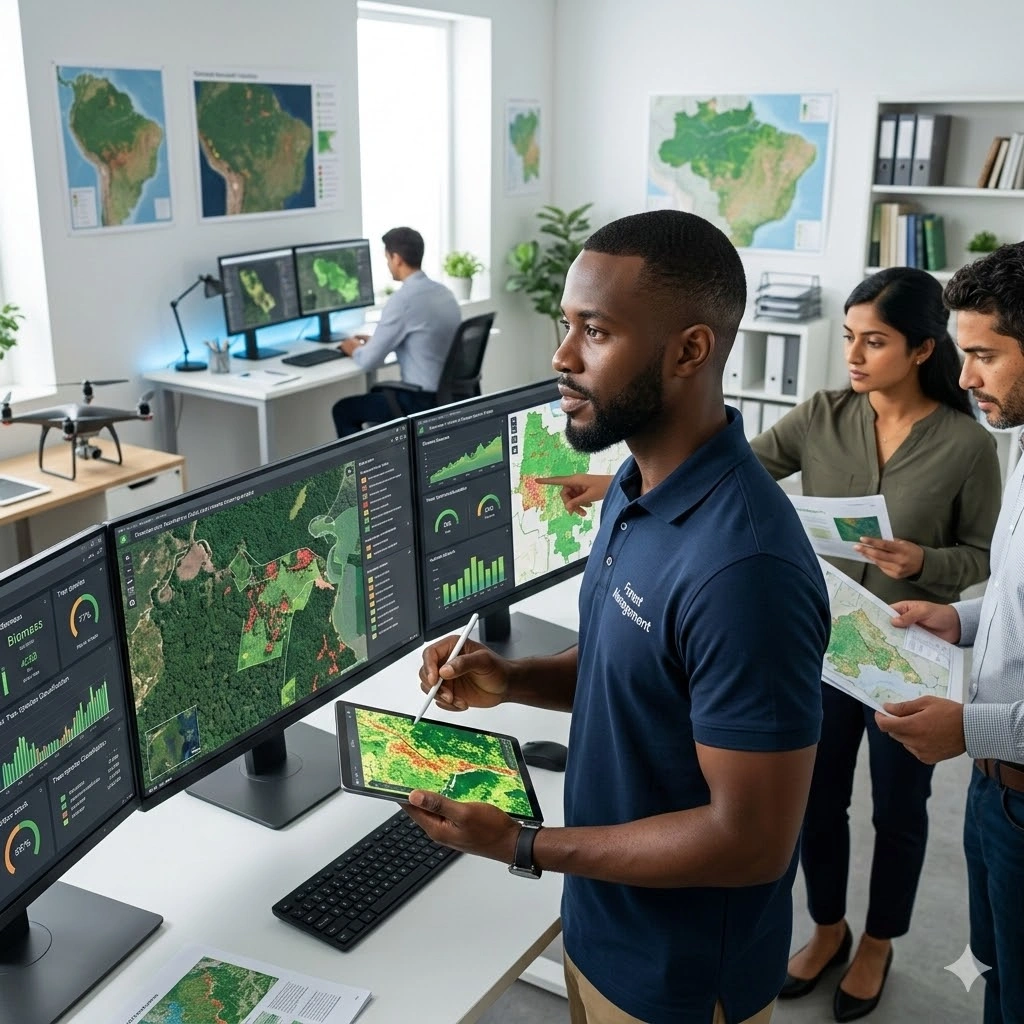
This course provides professionals with practical and advanced skills in applying GIS and Remote Sensing technologies for sustainable forest monitoring and management. Participants will learn how to use geospatial tools to map forest cover, monitor land-use change, detect deforestation patterns, and support conservation planning. The training emphasizes real-world applications aligned with climate action, biodiversity protection, and sustainable resource governance.
The program covers forest cover classification, change detection analysis, biomass estimation, carbon stock assessment, and spatial modeling for forest management. Participants will gain hands-on experience working with satellite imagery and GIS platforms to generate reliable spatial datasets that support evidence-based environmental decision-making and reporting requirements.
Through applied case studies and practical exercises, attendees will learn how to integrate GIS and remote sensing workflows into forestry programs, REDD+ initiatives, and climate reporting frameworks. By the end of the 10-day training, participants will be equipped to design and implement geospatial systems that strengthen forest monitoring, improve transparency, and enhance sustainable forest governance.
Duration
10 Days
Who Should Attend
• Forestry professionals and environmental managers
• GIS and Remote Sensing specialists in natural resources
• Climate change and REDD+ project teams
• NGOs, researchers, and government agencies in forestry and conservation
• University staff, consultants, and development practitioners
Course Impact
Organization Impact
-
Strengthened capacity to monitor forests with geospatial data
-
Evidence-based decision-making for conservation and forest governance
-
Better tracking of deforestation, degradation, and carbon stock changes
-
Improved compliance with international reporting (REDD+, SDGs, climate commitments)
Individual Impact
-
Hands-on skills in GIS & RS for forest monitoring
-
Proficiency in biomass and carbon assessment methods
-
Capacity to develop forest management plans using geospatial data
-
Enhanced expertise for career growth in forestry, environment, and climate change
Course Objectives
By the end of this training, participants will be able to:
-
Understand GIS/RS concepts for forest monitoring.
-
Map forest cover and detect land use/land cover (LULC) changes.
-
Apply RS for biomass, carbon stock, and biodiversity assessment.
-
Use GIS tools for forest management planning and policy support.
-
Develop monitoring frameworks for REDD+ and climate reporting.
Course Outline
Module 1: Introduction to GIS, Remote Sensing & Forest Monitoring
-
GIS & RS fundamentals in forestry
-
Importance of geospatial tools for sustainable forest management
-
Case Study: Global Forest Watch applications
Module 2: Data Acquisition & Preprocessing for Forest Studies
-
Sources of forest-related satellite imagery (Landsat, Sentinel, MODIS)
-
Pre-processing techniques: atmospheric correction, mosaicking, clipping
-
Practical: Downloading and preparing Landsat/Sentinel imagery
Module 3: Forest Cover Mapping & Classification
-
Supervised & unsupervised classification techniques
-
Forest/non-forest mapping
-
Practical: Land cover classification in QGIS/ArcGIS
Module 4: Deforestation & Degradation Monitoring
-
Change detection methods
-
Time-series analysis for forest loss trends
-
Case Study: Amazon rainforest deforestation monitoring
Module 5: Biomass and Carbon Stock Estimation
-
RS approaches for biomass and carbon assessment
-
Use of LiDAR and radar data
-
Practical: Estimating carbon stock with RS data
Module 6: Biodiversity and Habitat Mapping with GIS/RS
-
Species distribution modeling
-
Habitat fragmentation analysis
-
Case Study: GIS-based biodiversity corridors management
Module 7: Forest Fire Monitoring and Early Warning Systems
-
RS for fire detection and burned area assessment
-
Integration of weather data with GIS for fire risk mapping
-
Practical: Mapping hotspots using MODIS/VIIRS data
Module 8: Community-Based Forest Management & GIS Tools
-
Participatory mapping and community involvement
-
Integrating socio-economic data with geospatial layers
-
Case Study: GIS for community forest monitoring in East Africa
Module 9: Policy Applications – REDD+, SDGs & Climate Reporting
-
GIS/RS for REDD+ MRV (Monitoring, Reporting, Verification)
-
Forest monitoring indicators for SDG 13 (climate) and SDG 15 (life on land)
-
Practical: Setting up MRV frameworks with GIS
Module 10: Integrated Project & Presentations
-
Group project: mapping and analyzing forest change in a case region
-
Presentation of results and discussion
-
Case Study: National Forest Monitoring Systems (NFMS) best practices
Prerequisites
Course Administration and Investment
Whether you join us in a physical boardroom or through our virtual campus, we’ve designed every administrative detail for a seamless, professional experience.
Our fees are all inclusive during course hours.
- Covered: High level tuition, comprehensive materials (digital + physical), mid morning and afternoon refreshments, a full executive lunch, and any scheduled study visits or site tours.
- Not covered: Travel, visa fees, medical/travel insurance, personal expenses, and accommodation.
From registration to the classroom, we keep things clear and efficient.
- Registration: Find your preferred schedule, click “Register,” complete the form, and submit. Need help? Talk to us directly.
- Pre Course Assessment: After registering, you’ll receive a diagnostic survey to help facilitators tailor content to your needs.
- Joining Instructions: Once fees are paid, you’ll receive a Delegate Welcome Pack at least 7 days before the start date (venue maps, virtual access links, and pre reading materials).
We provide premium environments optimized for adult learning and networking.
- Physical Venues: Premium 4 star and 5 star executive boardrooms across our global host cities, with high tier catering.
- Virtual Instructor Led Training (VILT): High definition, interactive platforms featuring breakout rooms, digital whiteboards, and live technical support.
- NITA and Regulatory Compliance: Administrative processes align with national training authorities.
You’ll leave with tools that extend the course value far beyond the final day.
- ForElite Learner Kit: A physical or digital course manual, proprietary templates, and a curated toolkit of industry standard SOPs.
- On Site / In App Support: Dedicated course coordinators handle technical, dietary, or logistical inquiries in real time.
We validate your commitment to excellence with internationally recognized credentials.
- Attendance Tracking: Rigorous daily logging to meet corporate and regulatory accreditation requirements.
- Verifiable Credentials: Upon successful completion, you receive a certificate of course completion.
Our relationship with you doesn’t end when the course closes.
- Feedback & ROI Reporting: Detailed post course evaluations to give sponsors clear insight into training impact.
- Alumni Network Access: Every delegate joins the ForElite Alumni Network for ongoing peer to peer learning and exclusive webinars.
When is the next intake?
UpdatedWe offer customized training solutions tailored to your organization's specific needs (location, dates, content and team size).
Talk to us and we’ll guide you on the best schedule and format for your team.
Training Methodology
We turn knowledge into results. Using our P.E.A.K. Framework (Prepare, Engage, Apply, Know), every participant leaves with practical skills they can use immediately.
Proven Impact
In the last 12 months, over 1,200 professionals have applied the P.E.A.K. Framework to reduce onboarding time by an average of 30% and accelerate project delivery across 14 industries.
The outcome: Participants don’t just learn. They gain the tools, confidence, and strategy to drive measurable impact.
Tailor-Made Training and Customization
Off-the-shelf solutions rarely fit perfectly. At ForElite Training Institute, we built our Tailor-Made Training (TMT) service to embed our expertise directly into your unique strategy, culture, and operations.
We replace generic examples with scenarios from your sector (e.g., public sector, NGOs, financial services, or logistics).
Choose a format that fits your operations: intensive 3 day bootcamps or weekly sessions that minimize work disruption.
We teach directly from your actual templates, brand guidelines, or financial reports.
Host your bespoke training in any of our 21+ global cities, or we'll send facilitators to your office anywhere in the world.
Course Reviews
Share your experience to help others choose the right course.
Leave a Review
Your review will be published after verification.
Most Recent Reviews
Showing the most recent reviews.
Training on GIS and Remote Sensing for Sustainable Forest Monitoring and Management FAQs
Quick answers to common questions about this course
You May Also Be Interested In
Explore more courses in this category
 Advanced
 Advanced
 Intermediate
 Foundation
Advanced
Advanced
Intermediate
Foundation
Foundation
Advanced
Advanced
Intermediate
Foundation

SECURE YOUR COMPETITIVE ADVANTAGE TODAY.
Subscribe to the Premier Intel newsletter for weekly market insights and training updates.
About Us


ForElite Training Institute is a global institutional capacity-building and EdTech partner that empowers organizations and professionals with transformative, high-impact learning.
Explore
Mastery Tracks
More Mastery Tracks
