Training on GIS and Python for Agricultural Applications

Course Overview
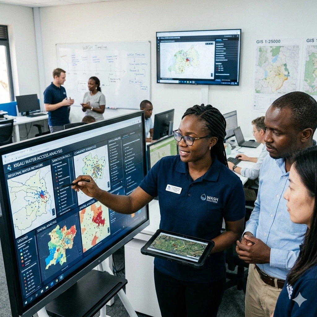
This course equips participants with the knowledge and practical skills to integrate Geographic Information Systems (GIS) and Python programming in agriculture. Participants will explore how geospatial data can be leveraged to analyze agricultural patterns, monitor crop health, manage soil resources, and support data-driven decision-making in farming operations.
Through hands-on exercises, learners will gain experience in spatial data management, Python scripting for geospatial tasks, and the use of GIS tools to model agricultural processes. Real-world datasets will be used to simulate precision farming, yield prediction, irrigation planning, and soil quality assessment, ensuring that participants can immediately apply the skills in practical contexts.
The course emphasizes sustainable and technology-driven agricultural practices. Participants will learn to design workflows that combine GIS and Python to optimize productivity, minimize resource waste, and improve the monitoring of large-scale agricultural systems. By the end of the course, attendees will be able to create insightful maps, perform advanced spatial analyses, and generate actionable reports to support agricultural research, planning, and operational efficiency.
Duration
10 Days
Who Should Attend
-
Agricultural professionals and researchers
-
GIS specialists applying spatial tools to agriculture
-
Data analysts and scientists in the agricultural sector
-
Agronomy students and educators
-
Farmers and agribusiness professionals
-
Anyone interested in combining GIS, Python, and agriculture
Course Impact
Organisational Impact
-
Enhances agricultural productivity by integrating GIS and Python for data-driven decision-making.
-
Supports precision farming initiatives, leading to cost reduction, efficient resource allocation, and improved yields.
-
Strengthens the organisation’s capacity for advanced crop monitoring, soil analysis, and risk assessment.
-
Promotes innovation by embedding technology-driven solutions into agricultural operations.
-
Builds in-house technical expertise, reducing reliance on external consultants for GIS and data analysis.
Personal Impact
-
Equips participants with in-demand GIS and Python skills tailored for agricultural applications.
-
Enhances career growth opportunities in precision agriculture, agribusiness, and agri-research.
-
Builds confidence in using modern tools for data analysis, mapping, and decision support.
-
Encourages innovative thinking and problem-solving through hands-on projects and real-world case studies.
-
Provides transferable skills applicable across agriculture, environmental management, and data science fields.
Course Objectives
By the end of this course, participants will be able to:
- Understand the basic concepts and principles of GIS and Python.
- Apply GIS techniques to agricultural problems and decision-making.
- Use Python programming to automate data analysis and processing tasks.
- Integrate GIS and Python for spatial data analysis in agriculture.
- Develop applications for precision agriculture, crop monitoring, and soil analysis.
- Analyze and visualize agricultural data to support informed decision-making.
- Work with remote sensing data and other geospatial datasets relevant to agriculture
Course Outline
Module 1: Introduction to Spatial Data and R
-
Overview of spatial data types
-
Introduction to R and RStudio
-
Installing and loading spatial packages in R
-
Practical Exercise: Set up RStudio and load spatial datasets
-
Case Study: Exploring a sample spatial dataset
Module 2: Data Import and Preprocessing
-
Importing spatial data (shapefiles, GeoJSON, etc.)
-
Cleaning and preprocessing spatial data
-
Coordinate reference systems and projections
-
Practical Exercise: Import a dataset, reproject coordinates, and clean data
Module 3: Spatial Data Visualization
-
Creating static maps with ggplot2 and tmap
-
Interactive mapping with leaflet and mapview
-
Customizing map aesthetics
-
Practical Exercise: Produce a thematic map of sample spatial data
-
Case Study: Visualizing urban population density
Module 4: Spatial Data Manipulation
-
Subsetting and filtering spatial data
-
Spatial joins and overlays
-
Buffering, dissolving, and other spatial operations
-
Practical Exercise: Perform overlays and buffer analysis on spatial layers
Module 5: Spatial Analysis Techniques
-
Point pattern analysis
-
Spatial autocorrelation (Moran's I, Geary's C)
-
Hotspot analysis (Getis-Ord Gi*)
-
Practical Exercise: Identify clusters and hotspots in a disease dataset
-
Case Study: Mapping crime hotspots in a city
Module 6: Spatial Regression and Modeling
-
Spatial regression models
-
Geographically Weighted Regression (GWR)
-
Spatial interpolation techniques (Kriging, IDW)
-
Practical Exercise: Build a spatial regression model to predict a variable
-
Case Study: Predicting property prices using spatial regression
Module 7: Integrating Spatial Data with Other Data Sources
-
Combining spatial and non-spatial data
-
Handling large spatial datasets
-
Practical Exercise: Merge spatial layers with socio-economic data
-
Case Study: Linking census data with health outcomes
Module 8: Automation and Advanced Topics
-
Writing functions and scripts for spatial analysis
-
Automating workflows with R
-
Introduction to advanced topics (e.g., spatial machine learning)
-
Practical Exercise: Automate repetitive spatial analysis tasks
Module 9: Case Studies and Applied Projects
-
Real-world spatial data applications
-
Group project work using provided datasets
-
Practical Exercise: Complete an end-to-end spatial analysis project
-
Case Study: GIS for environmental monitoring
Module 10: Conclusion, Review, and Further Resources
-
Recap of key concepts and techniques
-
Discussion of further learning resources
-
Project presentations and peer feedback
-
Practical Exercise: Present project findings and maps
Prerequisites
Course Administration and Investment
Whether you join us in a physical boardroom or through our virtual campus, we’ve designed every administrative detail for a seamless, professional experience.
Our fees are all inclusive during course hours.
- Covered: High level tuition, comprehensive materials (digital + physical), mid morning and afternoon refreshments, a full executive lunch, and any scheduled study visits or site tours.
- Not covered: Travel, visa fees, medical/travel insurance, personal expenses, and accommodation.
From registration to the classroom, we keep things clear and efficient.
- Registration: Find your preferred schedule, click “Register,” complete the form, and submit. Need help? Talk to us directly.
- Pre Course Assessment: After registering, you’ll receive a diagnostic survey to help facilitators tailor content to your needs.
- Joining Instructions: Once fees are paid, you’ll receive a Delegate Welcome Pack at least 7 days before the start date (venue maps, virtual access links, and pre reading materials).
We provide premium environments optimized for adult learning and networking.
- Physical Venues: Premium 4 star and 5 star executive boardrooms across our global host cities, with high tier catering.
- Virtual Instructor Led Training (VILT): High definition, interactive platforms featuring breakout rooms, digital whiteboards, and live technical support.
- NITA and Regulatory Compliance: Administrative processes align with national training authorities.
You’ll leave with tools that extend the course value far beyond the final day.
- ForElite Learner Kit: A physical or digital course manual, proprietary templates, and a curated toolkit of industry standard SOPs.
- On Site / In App Support: Dedicated course coordinators handle technical, dietary, or logistical inquiries in real time.
We validate your commitment to excellence with internationally recognized credentials.
- Attendance Tracking: Rigorous daily logging to meet corporate and regulatory accreditation requirements.
- Verifiable Credentials: Upon successful completion, you receive a certificate of course completion.
Our relationship with you doesn’t end when the course closes.
- Feedback & ROI Reporting: Detailed post course evaluations to give sponsors clear insight into training impact.
- Alumni Network Access: Every delegate joins the ForElite Alumni Network for ongoing peer to peer learning and exclusive webinars.
When is the next intake?
UpdatedWe offer customized training solutions tailored to your organization's specific needs (location, dates, content and team size).
Talk to us and we’ll guide you on the best schedule and format for your team.
Training Methodology
We turn knowledge into results. Using our P.E.A.K. Framework (Prepare, Engage, Apply, Know), every participant leaves with practical skills they can use immediately.
Proven Impact
In the last 12 months, over 1,200 professionals have applied the P.E.A.K. Framework to reduce onboarding time by an average of 30% and accelerate project delivery across 14 industries.
The outcome: Participants don’t just learn. They gain the tools, confidence, and strategy to drive measurable impact.
Tailor-Made Training and Customization
Off-the-shelf solutions rarely fit perfectly. At ForElite Training Institute, we built our Tailor-Made Training (TMT) service to embed our expertise directly into your unique strategy, culture, and operations.
We replace generic examples with scenarios from your sector (e.g., public sector, NGOs, financial services, or logistics).
Choose a format that fits your operations: intensive 3 day bootcamps or weekly sessions that minimize work disruption.
We teach directly from your actual templates, brand guidelines, or financial reports.
Host your bespoke training in any of our 21+ global cities, or we'll send facilitators to your office anywhere in the world.
Course Reviews
Share your experience to help others choose the right course.
Leave a Review
Your review will be published after verification.
Most Recent Reviews
Showing the most recent reviews.
Training on GIS and Python for Agricultural Applications FAQs
Quick answers to common questions about this course
You May Also Be Interested In
Explore more courses in this category
 Intermediate
 Intermediate
 Intermediate
 Intermediate
Intermediate
Intermediate
Intermediate
Intermediate
Intermediate
Intermediate
Intermediate
Intermediate

SECURE YOUR COMPETITIVE ADVANTAGE TODAY.
Subscribe to the Premier Intel newsletter for weekly market insights and training updates.
About Us


ForElite Training Institute is a global institutional capacity-building and EdTech partner that empowers organizations and professionals with transformative, high-impact learning.
Explore
Mastery Tracks
More Mastery Tracks
